Picture yourself stepping out the door to the sound of fast water and the smell of pine. That is Gallatin Canyon living. If you are weighing a home near the river, you also need a clear view of seasonality, access, and the everyday details that shape life here. In this guide, you will learn how river access really works, what changes with the seasons, and the practical checks that protect your purchase.
Gallatin Canyon at a glance
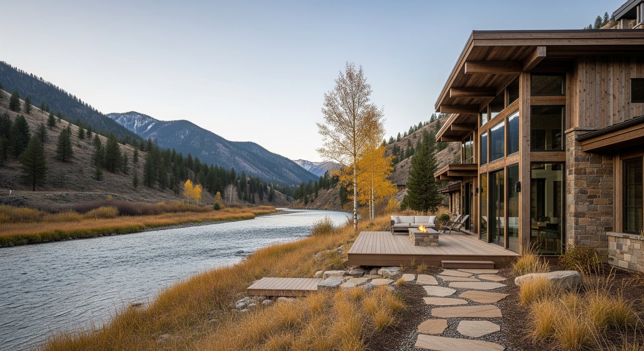
Gallatin Canyon follows the Gallatin River along US 191 between Bozeman-area foothills and the Big Sky approach. The corridor blends private parcels with Custer Gallatin National Forest lands. That mix creates a patchwork of public trailheads and pullouts alongside private riverfront homes.
Montana’s Stream Access Law allows you to recreate in rivers and streams up to the ordinary high-water mark. Getting to the water still requires legal access from a public point or a property you own. Expect a nature-forward setting where daily convenience varies by location and season.
River access basics
Public access to the river is concentrated at highway pullouts, bridge crossings, designated river-access points, and trailheads on public land. Between those points, riverbanks often run alongside private parcels.
- You may float, wade, or fish within the river corridor up to the high-water mark.
- You may not cross private land to reach the water without permission.
Buying riverfront property
If river time is a priority, ask a surveyor to confirm where your parcel meets the river and where the ordinary high-water mark lies. Title work should clarify any recorded easements. When a property ad says “river access,” make sure it means deeded access, not just proximity to a public pullout down the road.
Short stops vs trailheads
Roadside pullouts are great for quick wade fishing or a short stroll. Larger trailheads usually offer parking, restrooms, and longer routes that move away from the highway. Always check current Forest Service and FWP guidance for seasonal closures or restrictions before you go.
Micro-areas and feel
Lower Canyon and Gateway zone
Closer to Gallatin Gateway and Bozeman, you get gentler terrain and generally easier year-round access. Services and emergency response are typically closer here. Expect a mix of smaller wooded lots and tucked-away homes that balance privacy with practicality.
Middle Canyon
The central stretch along US 191 offers a mosaic of riverfront parcels, cabins, and public pullouts. You will find popular recreation staging areas and a steady hum of activity in peak seasons. Privacy varies by site and proximity to the highway.
Upper Canyon and Big Sky approach
As elevation rises, the terrain steepens and parcels become more scattered. Properties feel more remote and are closest to Big Sky amenities. Snow tends to arrive earlier and stay longer, which affects access and winter routines.
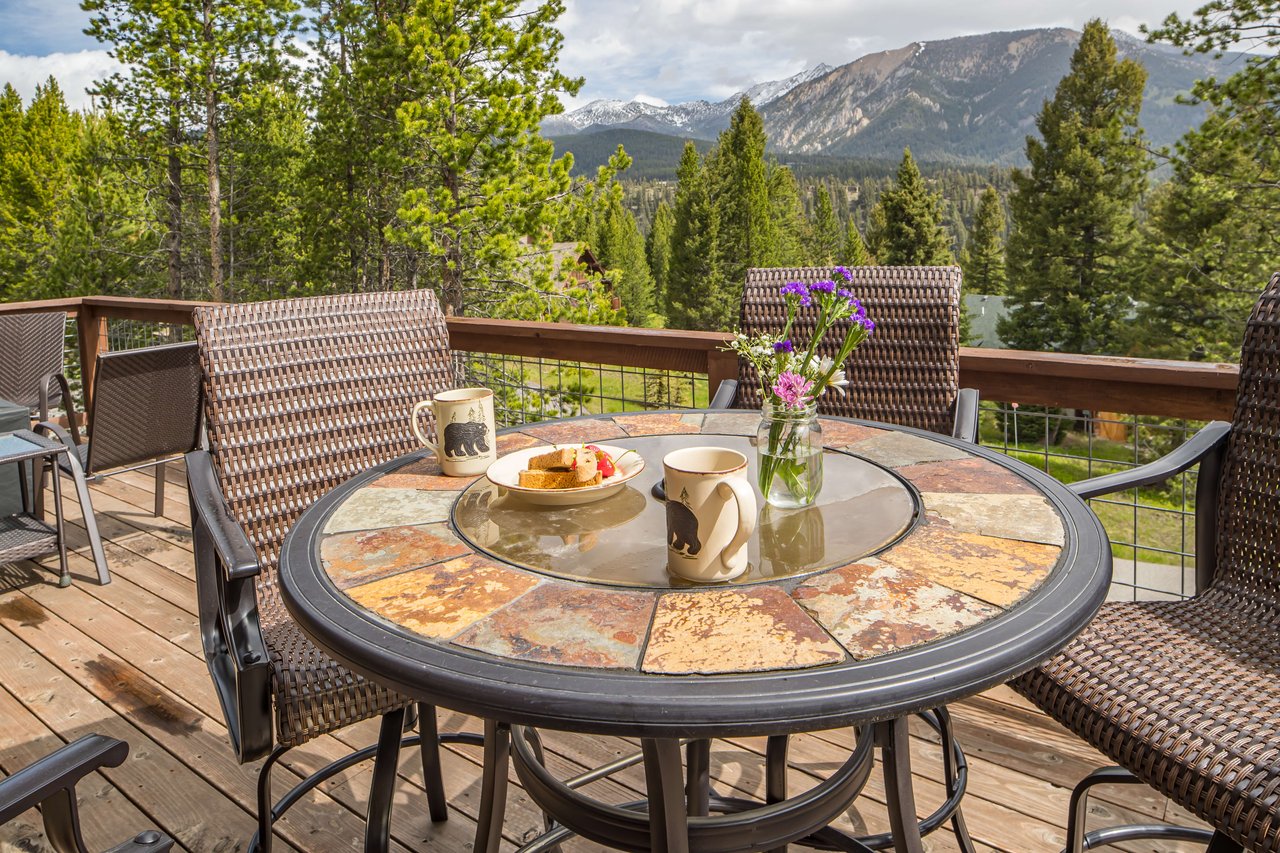
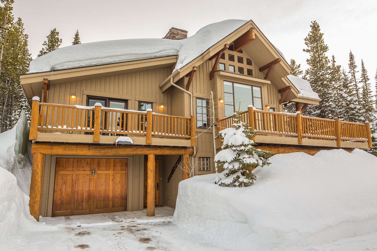
Home styles and lots
Architecture ranges from rustic log cabins and timber-frame builds to mountain-modern custom homes. Many designs emphasize natural materials, big windows, and low-impact living. Lots run from compact, forested sites to multi-acre parcels and small ranches.
Setbacks, slope, vegetation, and elevation shape build feasibility and cost. If you plan to build, factor in geotechnical work, driveway design, and defensible space. County planning rules and wildland-urban interface guidance can influence what and where you build.
Utilities and connectivity
- Water and sewage: Most properties rely on private wells and septic systems. Pull well logs and pumping tests, and verify septic permits through county records.
- Power and heating: Electricity is commonly grid-connected. Many homes heat with propane, wood, pellets, or natural gas where available. Backup heat and generator plans are common for remote parcels.
- Internet and cellular: Coverage is variable. Fixed wireless, satellite, or local ISPs may serve some addresses. Test carrier signal and run speed tests at the property.
- Roads and snow: Some roads are county maintained. Others are private and require owner or HOA plowing. Confirm who handles snow removal and what it costs.
Seasonality and daily life
Winter travel and access
US 191 is maintained year-round, but winter storms can bring heavy snow, drifting, and occasional closures. Travel times stretch, and traction devices may be advisable in severe conditions. Private drives and steeper sites often need contracted plowing and a winter plan for access.
Spring runoff and shoulder seasons
River levels rise with snowmelt, which changes bank accessibility and can affect nearby roads. Unpaved driveways may soften and rut. Plan maintenance for culverts, drainage, and erosion control.
Summer use and privacy
Summer brings anglers, rafters, and day-trippers. Parking fills at access points, and the corridor feels busier near popular pullouts and trailheads. If you value seclusion, focus on parcels set back from the highway or with thoughtful screening.
Safety, hazards, and insurance
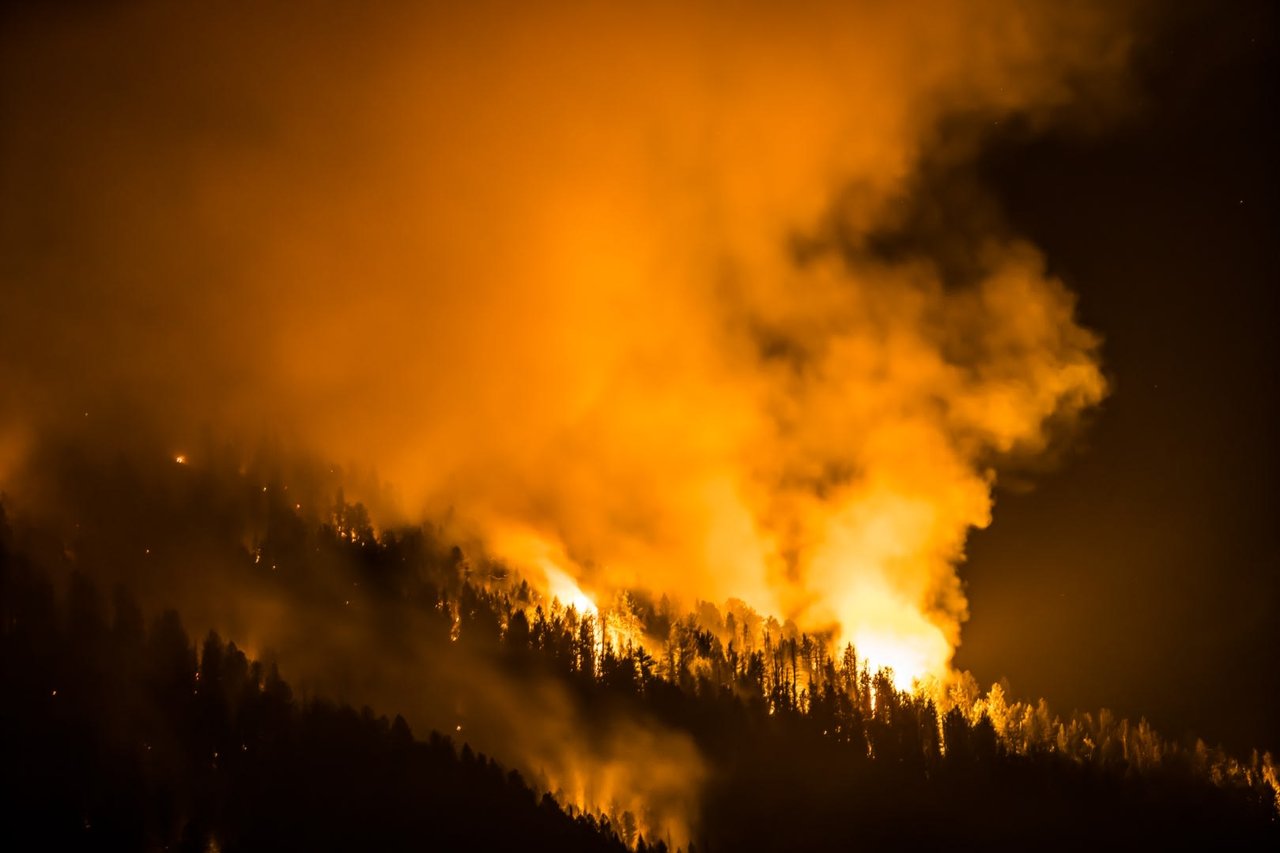
- Wildfire: Forest-edge parcels sit in higher-risk zones. Create defensible space and confirm coverage with your insurance agent.
- Flooding and erosion: Riverfront homes may lie in FEMA flood zones or along banks that shift over time. Review flood maps and ask for historical flood data for the parcel.
- Wildlife: Elk, deer, moose, and bears are common. Plan for secure trash storage and wildlife-wise landscaping.
- Emergency services: Response times are longer in remote stretches.
Buyer due-diligence checklist
Use this list to protect your purchase and your lifestyle goals:
- Confirm parcel lines and where the ordinary high-water mark sits. Order a survey if river proximity matters.
- Verify public river access points you plan to use and any deeded easements for private access.
- Pull well logs and water tests through county or state records.
- Confirm septic permit history, system type, and capacity. Budget for inspection or upgrades.
- Document road maintenance and snow removal responsibilities for private roads and drives.
- Review wildfire risk maps and fire district details. Plan defensible space.
- Check FEMA floodplain status and request recent flood history for the parcel.
- Test mobile and internet coverage on-site, and review provider maps.
- Ask for recent utility bills and seasonal costs, including propane, heating, and plowing.
Who Gallatin Canyon fits
Choose Gallatin Canyon if you want the river close at hand and a daily rhythm tied to the seasons. You get quick access to trails, fishing, and Big Sky’s alpine scene, with a range of home styles that put landscape first. If you prefer a quieter setting, look for sites set back from US 191 or higher on the slopes where views are wide and traffic noise drops.
How to start your search
Focus your criteria on river proximity, winter access, and utility setup. Decide how often you plan to be here in winter, how you want to reach the water, and what level of privacy you expect in summer. Then build a search that balances those priorities with budget and build feasibility.
If you are ready to explore available homes and land in Gallatin Canyon, reach out to Callie Pecunies for curated options and clear guidance from contract to close.
FAQs
Can I reach the Gallatin River from a new home?
- It depends on parcel boundaries and the ordinary high-water mark. Montana law allows recreation in the river corridor, but you must enter from a public access point or your own land.
How much does snow affect life in the canyon?
- Snow depth and duration increase with elevation. Lower-canyon homes tend to stay accessible most of winter, while upper-canyon areas see deeper snow and more frequent delays.
Are there many year-round residents in Gallatin Canyon?
- Yes. You will find a mix of full-time residents, commuters to Bozeman or Big Sky, and seasonal homeowners across the corridor.
Do I need special insurance for a river or forest-edge home?
- You may need wildfire and flood coverage depending on location. Availability and premiums vary, so consult local agents early in your process.
Which agencies should I check for conditions and rules?
- Look to Custer Gallatin National Forest for trailheads and closures, Montana Fish, Wildlife & Parks for river use and wildlife guidance, MDT for US 191 road advisories, Gallatin County for permits and records, and DNRC for water rights and well logs.